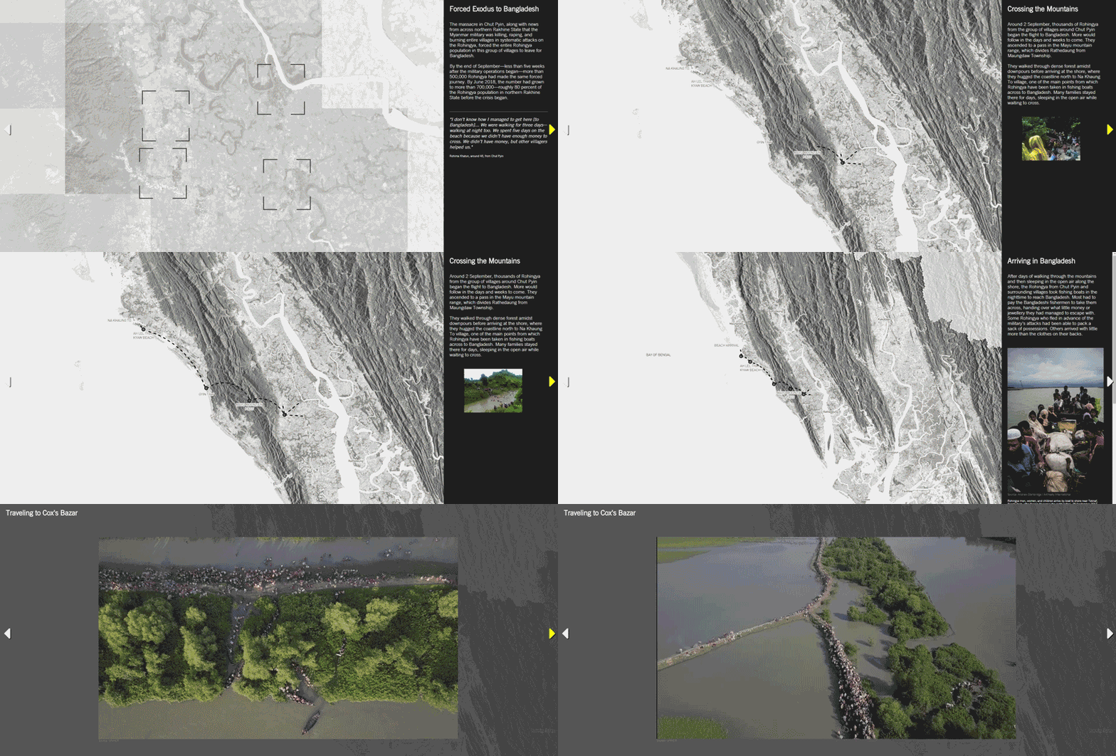
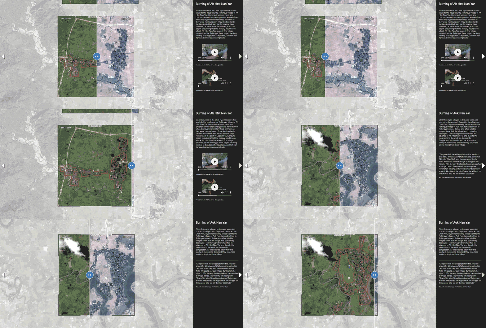
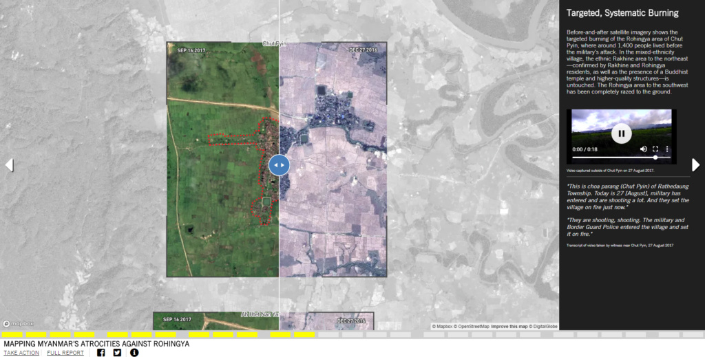
On Wednesday, SITU Research, an interdisciplinary practice within the Brooklyn-based firm SITU, launched a new collaboration with Amnesty International detailing the systematic destruction of the Rohingya Muslim population and its villages by the Myanmar military. This interactive digital platform weaves together evidence collected from maps, satellite images, testimonies, as well as verified photographs and videos to bring visibility to the atrocities.
Designed as a map-based narrative, the platform zeros in on the weeks leading up to the violence that started on August 25, 2017 against the Rohingya people in the northern Rakhine State. It then unveils how and where the military deployed their abusive efforts as well as the recent construction taking place on top of the destroyed villages.

In parallel with the platform, Amnesty released a 190-page report citing 13 Myanmar military and police officials as having played integral roles in these violent crimes. The human rights group claims to have evidence that crimes against humanity have been committed against the minority, and have forced over 702,000 people—more than 80 percent the area’s Rohingya population—to flee into Bangladesh. The intensive research shown in the written report and storied on the platform is based on over 400 interviews as well as expert forensic and weapons analysis on the military’s “clearance operations” following the initial attacks.
This is not the first comprehensive account of ethnic cleansing that SITU has helped make public. In late 2016, they teamed up with Amnesty to release their first interactive project together, a digital platform that charted 171 sites where war crimes were committed against civilians in the Jebel Marra region of Sudan.

Brad Samuels, a founding partner of SITU Research, said his team originally got involved with Amnesty in order to increase public accessibility to this type of information. With substantial visual evidence, they wanted to present a new form of reporting that leverages the benefits of interactive media.
“For us as architects and designers,” he said, “we’re interested in this sense of agency and using these kinds of tools and our skillsets to bring awareness to these types of larger, political issues. We use mapping, 3D modeling, and visual intelligence to create major impact in a new way.”
Samuels leads SITU Research’s Spatial Practices as Evidence and Advocacy (SPEA) projects, which use data visualization and satellite mapping to advocate for awareness on human rights abuses around the world.
