In Jorge Luis Borges’s 1946 one-paragraph short story “On Exactitude in Science,” a fictional 17th-century individual, Suarez Miranda, tells of a time that the “Cartographers Guilds” made a map of their empire so accurately that it matched it entirely, at 1:1 scale, point by point. Of course, this map was utterly useless. This meditation on mapping and empire seems increasingly prescient today, as every last plot of the Earth becomes represented and possessed in cartography, in satellite imagery, in Google Street View, and through intricate digital models. Enter Cityzenith, the Chicago-based startup where the CEO’s reported mission, according to the trade publication Building Design and Construction, is to “replicate our entire world,” one hopes with more utilitarian results than those in Borges’s cautionary tale.
Cityzenith’s digital twin technology is part of its Smart World Pro software suite, which pulls together data from builders, developers, building owners, cities, and IoT devices to create hyper-detailed “supermaps” of buildings and cities. As Cityzenith CEO Michael Jansen explained to the BBC, “[a] digital twin is a virtual representation of physical buildings and assets but connected to all the data and information around those assets, so that machine learning and AI algorithms can be applied to them to help them operate more efficiently.”
With these twins, users—building owners, urban designers, environmental engineers, governments—can both monitor existing infrastructure, and simulate the effects of new buildings or what different conditions like temperature change or congestion could cause for existing architecture and for city dwellers, all from a single digital dashboard. Information from everything from Excel sheets to GIS data to social media posts can be dragged and dropped to help create models, incorporating over 1,000 datasets.
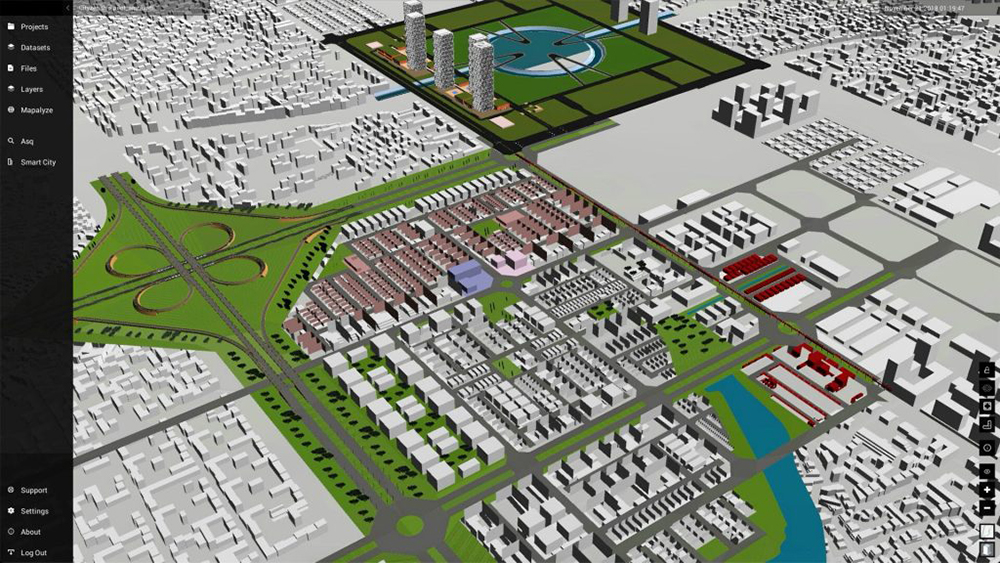
While Cityzenith is not the first company to push digital twins as an option for developers, builders, and planners, it’s one of the first to propose using the technology as a way to design a city from the ground up. Cityzenith claims the Foster + Partners and Surbana Jurong–designed $6.5 billion planned city Amaravati, to be the capital of Andhra Pradesh, India, will be the world’s first city “born as a digital twin.” This new capital was deemed necessary after the shifting of state lines left Andhra Pradesh without a capital. The city is being planned from the ground-up as a smart city for 3.5 million people, in part by leveraging Cityzenith’s Smart World Pro software, the latest version of which launched this winter.
Data about construction, design, current and projected environmental conditions, mobility and traffic, and climate can be viewed in the desktop interface, and simulations that leverage machine learning and artificial intelligence can get ahead of what’s happening at a variety of scales. For example, if simulations of high-temperature conditions show most pedestrians will be forced to seek shaded streets during rush hour, how does this congestion shape the city? And how can the city be shaped to prevent it?
Permits can be drag-and-drop submitted, and zoning, traffic, and environmental analysis for the entire city is streamlined and accessible from a single window. Builders and developers can get info from a simple web interface. A video from Cityzenith shows a Siri-like natural language search web tool, as well. The company also proposes a “digital twin user ID” for every Amaravati citizen that will let them visit government portals to access tools from their city’s digital twin.
In an era of big data, simulation, and hyper-detailed mapping, Borges’s 1:1 map doesn’t feel far off. One can imagine a future where we’re better off traveling on our computer screen’s representations of a “digital twin.” Or we can just play SimCity instead.
For more on the latest in AEC technology and for information about the upcoming TECH+ conference, visit techplusexpo.com/nyc/.
